
The West
Highland Way.
96 miles from the edge of Glasgow to the foot of Ben Nevis.
Loch shores, old military roads, lonely moorland and some of
the most dramatic scenery in Scotland.
Miles
Kilometres
Typical Days
Highest Point
THE JOURNEY NORTH
There are plenty of ways to see Scotland.
You can drive through Glencoe, pull into the viewpoints, take the
photograph and be back on the road ten minutes later. You can watch
Loch Lomond slide past the window. You can stop beneath Ben Nevis,
wander around Fort William and head north again.
But walking through Scotland is different.
On foot, the landscape doesn’t simply appear in front of you.
You have to earn it.
Mile by mile, the suburbs disappear. Roads become tracks. Tracks
become paths. Lochs stretch alongside you for hours. Mountains that
looked distant in the morning gradually tower above you by afternoon.
And somewhere along the way, the modern world starts to feel very
far away.
That is the magic of the West Highland Way.
Running approximately 96 miles (154 km) from Milngavie,
just outside Glasgow, to Fort William in the Scottish Highlands,
the West Highland Way is Scotland’s most famous long-distance
walking route.
But describing it simply as a 96-mile walk doesn’t really do it justice.
It’s a journey from Scotland’s populated Central Belt into
increasingly wild Highland country — through woodland, alongside
lochs, across open moorland and eventually beneath some of the most
dramatic mountains in the country.
Scotland looks different when you’ve travelled through it
at three miles an hour.
THE BEGINNING
From Milngavie
to the Highlands.
The adventure begins somewhere surprisingly ordinary.
Milngavie sits only a short distance north of Glasgow, and the
official West Highland Way marker stands right in the centre
of town.
There are cafés, supermarkets, buses and people going about
their normal lives.
Then you start walking north.
The first few miles gently introduce you to the route rather
than throwing you immediately into the Highlands. Woodland
paths and old tracks carry you towards the countryside
surrounding the Campsie Fells.
The distinctive shape of Dumgoyne soon
appears ahead.
This is one of the great things about the West Highland Way:
you can physically watch Scotland changing around you.
For many walkers, the first major destination is
Drymen.
Then Loch Lomond
appears.
CONIC HILL & BALMAHA
Crossing into the Highlands.
Leaving Drymen behind, the route heads towards Balmaha.
Between the two lies one of the first genuinely spectacular
moments of the West Highland Way:
Conic Hill.
The climb isn’t enormous compared with what lies farther north,
but its position makes it special.
As you gain height, the landscape begins opening behind you.
Then Loch Lomond appears.
From the hillside you can look across the islands scattered
through the southern end of the loch and towards the mountains beyond.
Down below sits Balmaha, on the eastern shore
of Loch Lomond.
From here, the character of the West Highland Way changes again.
The loch becomes your companion.
And it will remain one for a very long time.
LOCH LOMOND
The long road
along the loch.
Looking at a map, the Loch Lomond section can appear
straightforward.
Follow the eastern shore north.
Easy.
Anyone who has actually walked it may smile at that description.
Around Balmaha and Rowardennan, woodland, beaches and little
bays sit beneath Ben Lomond.
Farther north, however, things become considerably rougher.
The stretch around Inversnaid towards Inverarnan
twists through woodland and clambers over rocks and tree roots.
Progress can be much slower than the mileage suggests.
But it is also wonderfully atmospheric.
Eventually the northern end of the loch approaches.
After spending so long beside it, leaving Loch Lomond behind
feels surprisingly significant.
The journey is moving deeper into the Highlands.
04 · GLEN FALLOCH
North towards Tyndrum.
Beyond Inverarnan, the landscape opens again as the Way follows
Glen Falloch north.
Waterfalls tumble down the hillsides. The railway and road
occasionally appear nearby, but the mountains increasingly
dominate everything around them.
Eventually the route reaches Crianlarich and
then Tyndrum.
Tyndrum is an important psychological point on the journey.
Food.
A bed.
Dry socks.
A chance to replace forgotten equipment, replenish supplies and
find something hot to eat.
But from Tyndrum onwards, the West Highland Way begins entering
some truly magnificent country.

TYNDRUM → BRIDGE OF ORCHY
Everything suddenly
feels enormous.
The trail leaving Tyndrum follows an old military road through
a huge Highland landscape.
Ahead rises the unmistakable shape of
Beinn Dorain.
The sky.
The distance.
Eventually you descend towards Bridge of Orchy.
Cross the bridge and another climb begins.
From the high ground near Mam Carraigh, the landscape opens
towards Loch Tulla and the mountains beyond.
On a clear day, it is spectacular.
On a dark, misty Highland day, it can be even more atmospheric.
Ahead lies Rannoch Moor.
Nothing but
moorland, water
and mountains.
There are places in Scotland where you suddenly understand just
how much empty land still exists here.
Rannoch Moor is one of them.
The West Highland Way crosses this vast expanse using the old
military road.
In good weather it can feel liberating.
In poor weather it can feel intimidating.
There is little shelter and conditions can change rapidly.
This is one of those sections where Scotland dictates the experience.
Sunlight can break through clouds and illuminate entire mountainsides.
Twenty minutes later, rain can sweep horizontally across the moor.
Then the clouds part again.
Eventually something familiar begins appearing ahead.
Buachaille Etive Mòr.
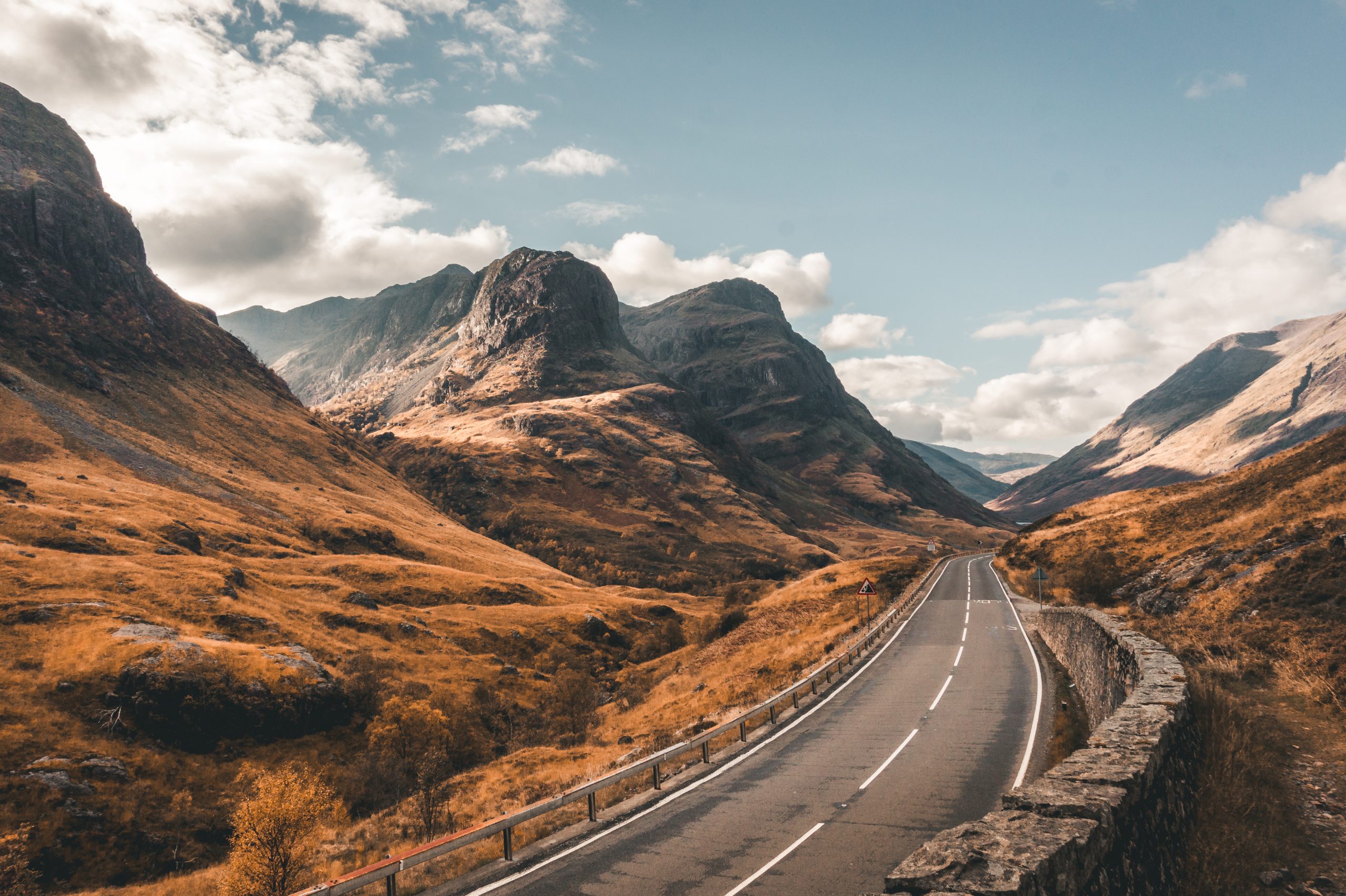
Its great pyramidal northern face marks the entrance towards Glencoe.
Sitting beneath it is one of the most famous stopping points on
the entire West Highland Way.
The Kingshouse.
Kingshouse
& Glencoe.
For walkers arriving after crossing Rannoch Moor, Kingshouse
can feel like an oasis.
Civilisation has returned.
But only just.
Buachaille Etive Mòr dominates one direction.
Glencoe lies ahead.
Deer are regularly seen wandering around the surrounding ground,
and when evening light hits the mountains this is one of those
places where you simply sit outside and stare.
The next section follows the old military road towards Glencoe.
Then you reach Altnafeadh.
Look upwards.
The path climbing sharply into the mountains is the
Devil’s Staircase.

The Devil’s
Staircase.
The name is considerably more frightening than the reality.
But after walking most of the way from Glasgow, your legs may disagree.
The Devil’s Staircase zigzags upwards to the highest point of the
West Highland Way, at around 550 metres above sea level.
Take your time.
And remember to turn around.
Behind you, the view towards Buachaille Etive Mòr and across
the surrounding mountains becomes increasingly spectacular.
Then comes the long descent to Kinlochleven.
09 · THE FINAL DAY
Kinlochleven
to Fort William.
The final morning begins with a climb.
Naturally.
Leaving Kinlochleven, the trail climbs steeply before entering
the remote valley of Lairig Mòr.
Ruined buildings sit beside the trail, reminders that these
apparently empty landscapes weren’t always so empty.
By now, something strange often happens.
After spending days wanting the finish line to get closer,
you realise you don’t particularly want the walk to end.
Put your boots on.
Walk north.
Eat when you’re hungry.
Stop when you’re tired.
Look at Scotland.
Repeat.
Eventually forestry tracks begin appearing.
Then you catch glimpses of something enormous.
Ben Nevis.
Britain’s highest mountain dominates the skyline as the trail
approaches Glen Nevis.
And suddenly the wilderness begins disappearing.
You’ve
made it.
After roughly 96 miles, the famous bronze walker at the
finish line suddenly feels extremely relatable.
Seven days
on the Way.
Most walkers take around six to eight days.
Here’s a comfortable seven-day starting point.
Milngavie → Drymen
Approx. 12 miles
Drymen → Rowardennan
Approx. 15 miles
Rowardennan → Inverarnan
Approx. 14 miles
Inverarnan → Tyndrum
Approx. 12 miles
Tyndrum → Kingshouse
Approx. 19 miles
Kingshouse → Kinlochleven
Approx. 9 miles
Kinlochleven → Fort William
Approx. 15–16 miles
Have the coffee. Sit beside the loch. Take your boots off.
Talk to the other walkers. Watch the weather roll across the mountains.
Those moments often become as memorable as the famous viewpoints.
What should
you pack?
Scotland’s weather should never be underestimated.
Even during summer, a beautiful morning can become a wet,
windy afternoon remarkably quickly.
Good waterproofs are essential. So are boots or trail shoes
you’ve already worn before beginning the trail.
- Waterproof jacket & trousers
- Broken-in walking boots or trail shoes
- Good walking socks
- First-aid & blister kit
- Water bottle / hydration system
- Power bank
- Warm insulating layer
- Hat & gloves
- Midge repellent
- Midge head net
- Sunscreen
- Waterproof backpack liner
- Offline navigation
- Food & snacks
- Spare dry clothing
The Midges.
During the warmer months, particularly on still and damp
evenings, Highland midges can be brutal.
Carry repellent. Carry a head net.
Wind, however, is your friend. Midges are poor flyers,
so breezier conditions can completely transform an evening.
Pick your season.
April–May
Longer days and usually fewer midges.
June
Huge daylight hours and beautiful light.
July–August
Summer, busy trails and midge season.
September
Quieter trails and early autumn colour.
HOW HARD IS IT?
It’s not one hard day.
It’s seven of them.
Technically, much of the West Highland Way isn’t particularly
difficult during normal walking conditions.
The challenge comes from doing it repeatedly.
Day after day.
The cumulative mileage works its way into your legs and feet.
Loch Lomond can be rocky and tiring. Rannoch Moor is exposed.
The Devil’s Staircase comes after you’ve already travelled a
considerable distance.
And the final climb out of Kinlochleven arrives when your body
is well aware that you’ve been walking across Scotland for the
best part of a week.
Walking 15 miles once is one thing.
Walking another 15 the following morning is quite another.
MORE THAN A WALKING TRAIL
The thing you remember
isn’t always the view.
The first coffee after hours in the rain.
Taking your boots off beside a river.
The stranger who keeps appearing at every overnight stop.
The silence on Rannoch Moor.
The first sight of Buachaille Etive Mòr.
The moment Ben Nevis appears ahead.
“I’m actually going to finish this.”
WANDERING SCOTLAND
Scotland is better
when you slow down.
From the edge of Glasgow to Loch Lomond. Into the Highlands.
Across Rannoch Moor. Through Glencoe. Over the Devil’s Staircase.
And finally into Fort William beneath Ben Nevis.
Ninety-six miles sounds like a long way when you’re standing
at the starting marker in Milngavie.
By the time you’re standing at the finish in Fort William,
somehow it doesn’t feel quite long enough.
Go beyond the postcard.
Walk into it.
